Narrow entrance
The narrow entrance does not present any special issue with fair weather or wind from the N to NE. Caution should be exercised with prevailing winds from the W to S (monsoon / habagat). Do not enter at night if you don’t know the place.
Charts for OpenCPN can be downloaded for this area here: https://hackingfamily.com/Cruise_Info/Equipment/Chart_Downloads.htm
The CMap chart is not accurate. Navionics is. Of course the sat charts are fine, but only Bing shows any details of the entrance.
Routing
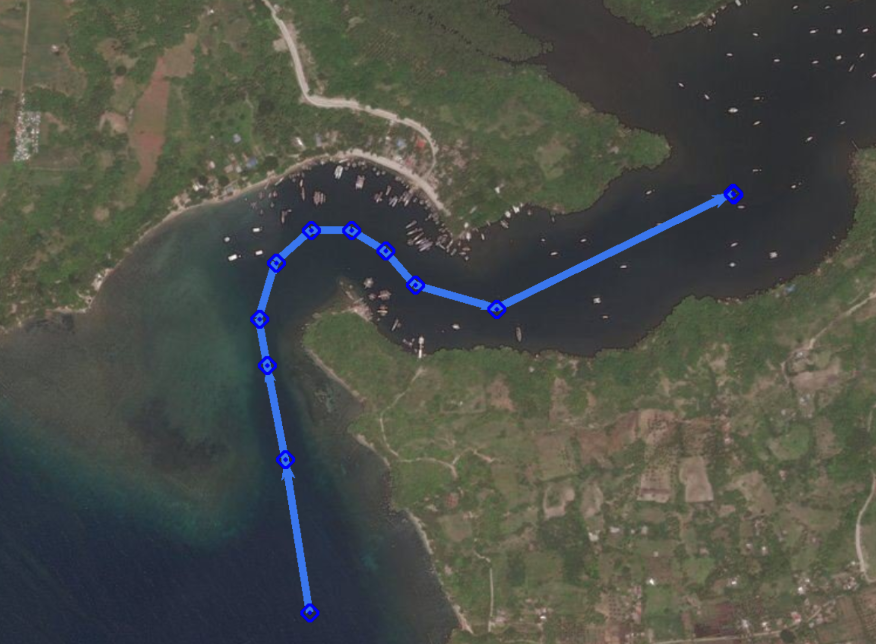
Below is a picture of the entrance on Navionics charting. The list shows the waypoints for this sample route.
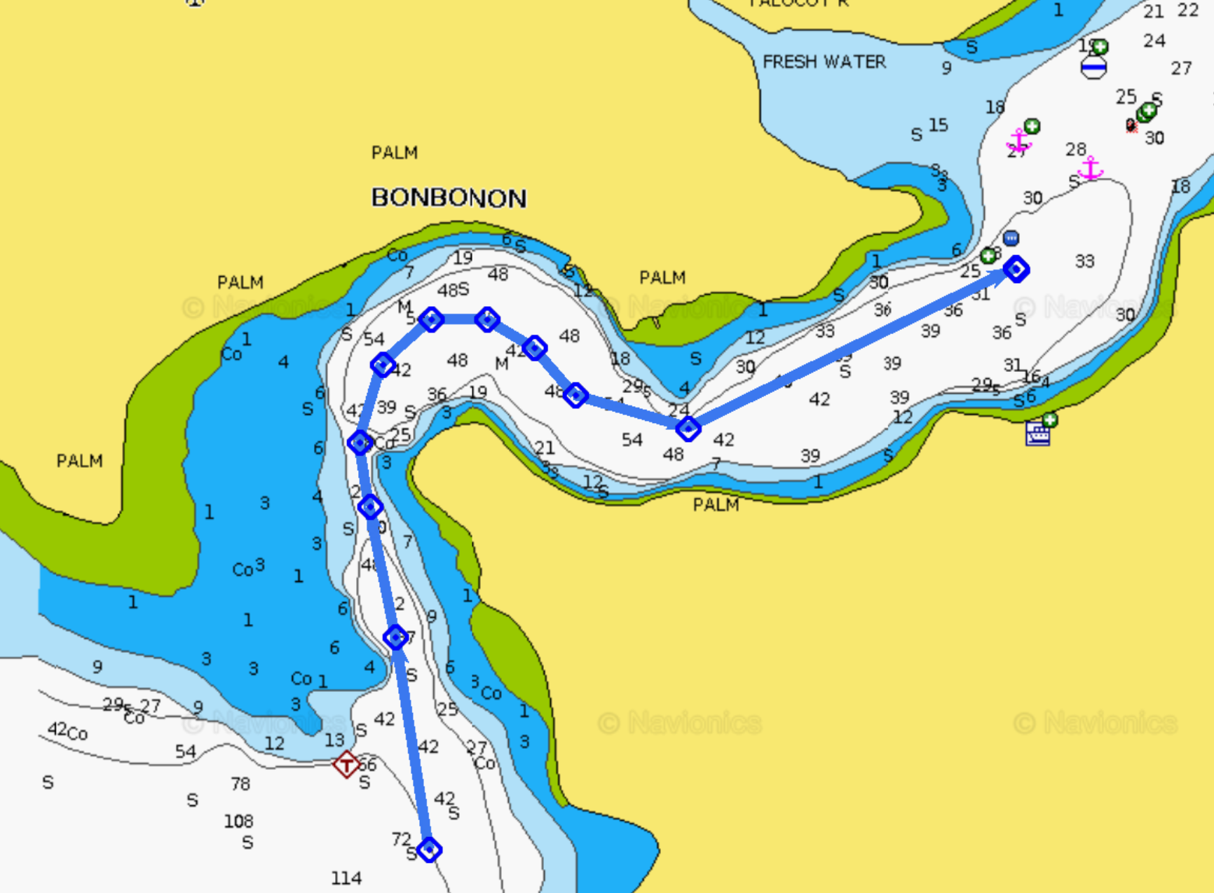
| 01 | 09° 02.9337′ N | 123° 07.0630′ E |
| 02 | 09° 03.1004′ N | 123° 07.0361′ E |
| 03 | 09° 03.2026′ N | 123° 07.0159′ E |
| 04 | 09° 03.2532′ N | 123° 07.0075′ E |
| 05 | 09° 03.3145′ N | 123° 07.0257′ E |
| 06 | 09° 03.3493′ N | 123° 07.0646′ E |
| 07 | 09° 03.3493′ N | 123° 07.1086′ E |
| 08 | 09° 03.3273′ N | 123° 07.1458′ E |
| 09 | 09° 03.2900′ N | 123° 07.1784′ E |
| 10 | 09° 03.2639′ N | 123° 07.2681′ E |
| 11 | 09° 03.3887′ N | 123° 07.5283′ E |
From the last waypoint, the whole mooring / anchoring area will be in view. See Anchoring or mooring .
Of course the skipper is fully responsible for the route taken by the yacht through the entrance.