The weather in Tambobo Bay is dominated by three distinct regimes related to the pressure distribution in the northwest Pacific: trade winds fom the WNW (Amihan) in the winter and monsoon from the WSW (Habagat) in the summer.
In between, the weather is mostly dependant on the position of the ITCZ and forecasts are mostly inaccurate during this period.
Due to the local orography, mountains to the north of the Bay and Mindanao to the south, the winds are accelerated through a venturi effect and its stronger periods match the orientation of the bay ENE / WSW.
During most days, the thermal effects are felt through acceleration of the wind during the day hours, especially during ENE winds.

Some days, especially late during the typhoon season, the WSW winds can reach speeds in excess of 50 kts, with gusts reaching 70 kts or more when a typhoon transits in the near Pacific. Boats will risk a major incident if not anchored with a proper technique outside of the mooring field or on a badly maintained mooring.
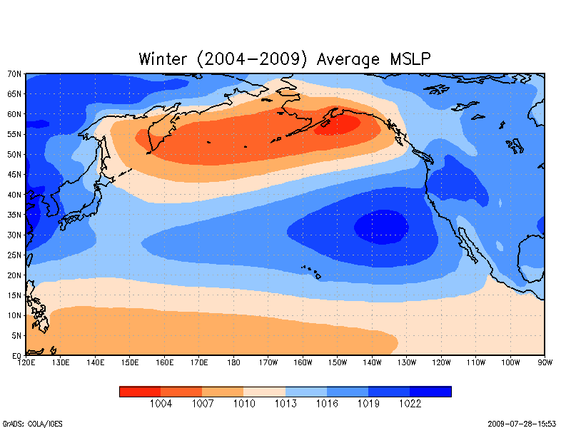
Winter
The WNW trade winds affecting the Philippines are reinforced. The air is cooler and drier, making it an agreeable season.
The winds generally peak at 20 to 25 kts from the WNW during the day, with its peak early afternoon. Gusts are moderate. This is the dry season with very little rain…
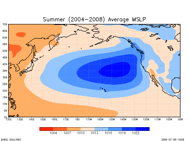
Summer
The surface winds have turned to the WSW bringing hot and humid air to the region. This is the rainy season with frequent rain.
Winds are moderate up to 25 to 30 kts, with the exception of typhoon induced winds in excess of 50 kts.
There are usually more boats moored in the Bay, so caution is warranted at all times during strong wind episodes.
In Between
The time between the two main seasons is mainly affected by the position of the ITCZ, moving south in the spring and north in the fall.
The weather is unsteady, sometimes windy and gusty with rain and thuderstorms.
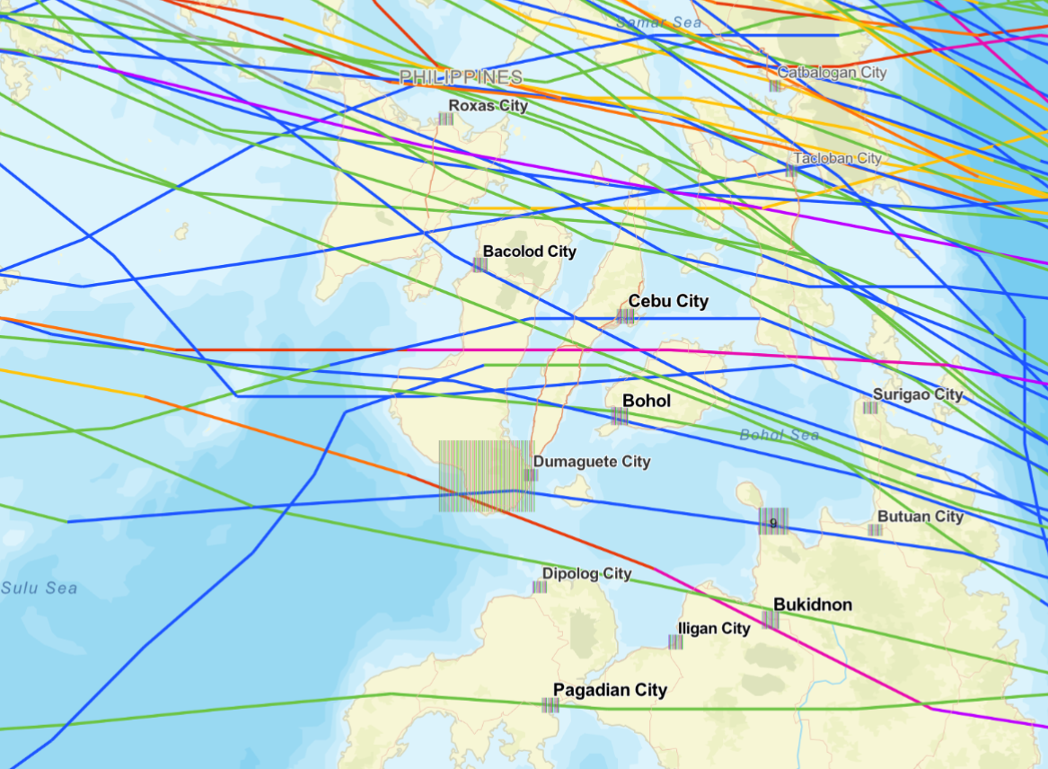
Typhoons
They affect the southern Negros region when their trajectory brings them close to the east coast of the Philippines. Very rarely does any typhoon pass in the close vicinity of Tambobo Bay. The risk increases towards the end of the year with the north Pacific high starting to block their path towards the north.
Major storms which have affected the southern Negros region more recently:
- BOPHA 2012. Cat H2. Closest to Tambobo: 4 Dec 2012, 959 hPa, 85 kts.
- RAI 2021. Cat H3. Closest to Tambobo: 16 Dec 2021, 951 hPa, 110 kts
- MAN-YI 2024. Cat H5. Closest to Tambobo: 16 Nov 2024, 924 hPa, 140 kts